Transits
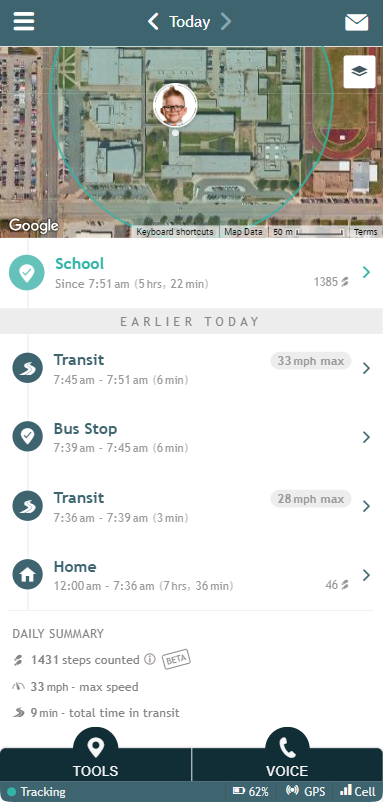
A Transit entry shows in the AngelSense app Timeline anytime the AngelSense device is in movement from one Place to the next. This can be when walking, driving, bicycling, etc.
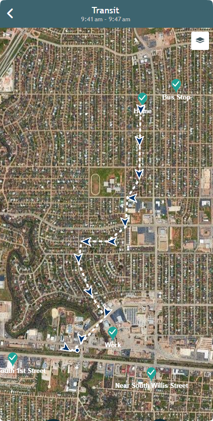
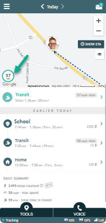
Clicking on transits shows their route on a map as below. If the transit is the top one in the timeline, clicking on it will show the route updating in real-time.
*All of your named locations will also show on the map with a check mark
Location updates in transit are made every 30 seconds and presented as an arrow. For 10 second updates, you can use Runner Mode.
During Transit, AngelSense automatically identifies every stop that is more than 5 minutes in the Timeline.
If the maximum speed reached over 15 mph (24 km/h), the Timeline will present the maximum speed of the journey once the transit is over.
During a transit, you can see the speed of the last reported GPS at the bottom of your map.


